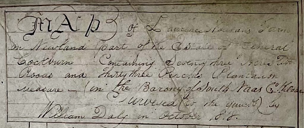
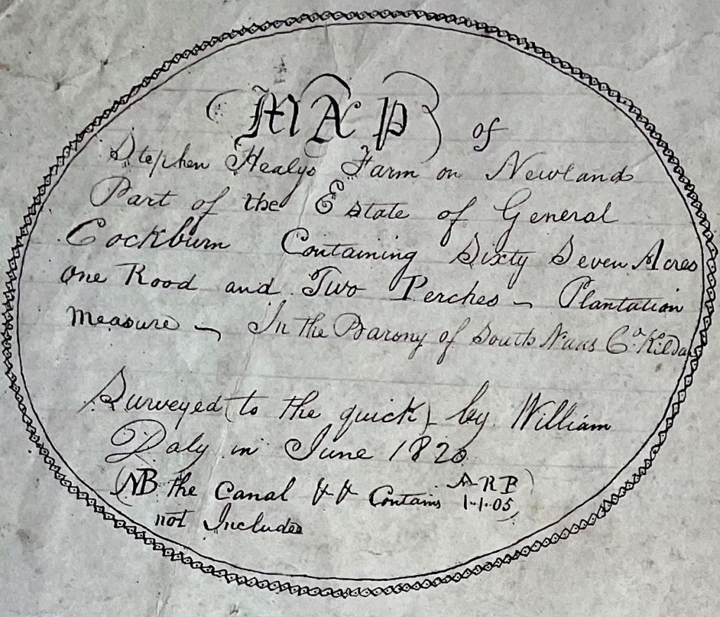
The Maps of Corbally Canal on the Newlands Estate were drawn by one William Daly between the years 1815 to 1821. The following are details of leases on the nearby lands held by A. H. Rowan at Stephenstown, Two Mile House, at that time. William Connor’s farm is included because it was from here that the chapel site and graveyard of 2 roods was given to the community.
| William Connor | Dec.1819 | 41 acres | Life of lessee and 31 years | |
Peter Daly | May 1820 | 18 acres | Lives, lessee, Will. & John | £16-16-0 |
Peter Daly’s son William, mentioned above, may well be our surveyor. It looks likely that William was the product of a hedge school in the late 18th and/or early 19th Centuries. Rawson in The Kildare Statistical Survey of 1807 states: “So much did the people want education for their children that they often paid more for it than they could afford. The boys paid a half crown or 5/- a quarter. All over the country are numbers of schools where the lower orders have their children instructed in writing, arithmetic and reading; scarcely a peasant who can muster a crown after tithe and priest’s dues (and rent), but is emulous to expend it on his little boy’s education. No Sunday schools, no encouragement of the neighbouring gentry”. Thomas Francis Meagher pays a fine tribute to the character of James Nash, as he records the death of the old schoolmaster: “Like all the poor, honest, gifted men – who thought more of their country than themselves – he died in utter poverty, companionless and nameless” – not much encouragement for the patriot, I’m afraid. Daly may have worked for Sir George Cockburn in some capacity. Could he have been a schoolmaster? We may never know – he has left nothing that I know of but his maps. Did he begin by learning the basic skills in the hedge school at Two Mile House, and later on work with a surveyor? Maps being so important in the regulation of rents and tithes, and the consolidation of mearings, there was always some activity in this area, and before the Ordnance Survey did their work it was up to landlords to have their own maps done. Because Rowan lived for some time at Rathcoffey, near where the Bog Reports and their comprehensive maps were being drawn up, was it possible that he gained some experience there? There was also much surveying with the construction of canals and the many military activities around the county.
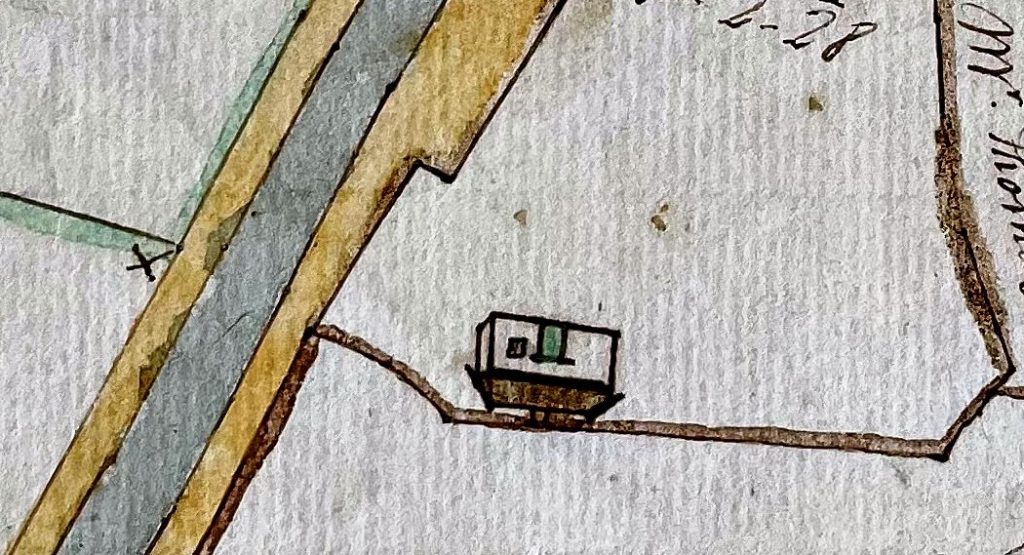
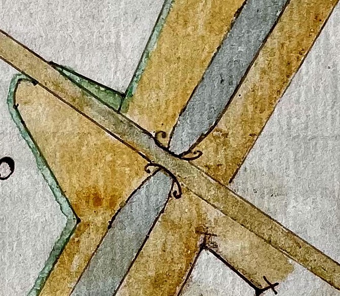
While accurate, the maps are not pretentious and are all the more charming for it. Some are done on parchment, not evenly cut, outer margins not square; some done on mere scraps of parchment; others done on paper watermarked “Boldbrook”. The Encyclopaedia Britannica of the year 1902 gives an account of the simple implements used for surveying in the past. They were the chain, rod, cross staff, marking poles and compass. The chain was 66 feet long with 100 links. The rod was 10 links in length and could be easily made by the surveyor. Likewise the cross staff, with which a right angle could be quickly made. For making a more accurate right angle a string with knots at intervals of units of 3, 4 and 5 or multiples thereof could be used. When this string was made taut the right angle at the base was lined up with the apex of the triangle. The most reasonable method was to mark off as large a triangle as possible in the field. Poles would mark the two ends of every chain. The sides of the triangle could then be measured and the area worked out. Alternately the base of the triangle could be measured together with the perpendicular height. Smaller triangles could then be marked out. Eventually the tiny bits left over could be estimated. A tedious business no doubt! But then time wasn’t so urgent two hundred years ago and the surveyor would have plenty willing hands for a little recompense. To put down the information on paper the mapmaker would first decide on his scale, then pinpoint the apices of each triangle on the map. The points would then be joined up and the shape of the field appeared. In many such maps the pin pricks are still visible.
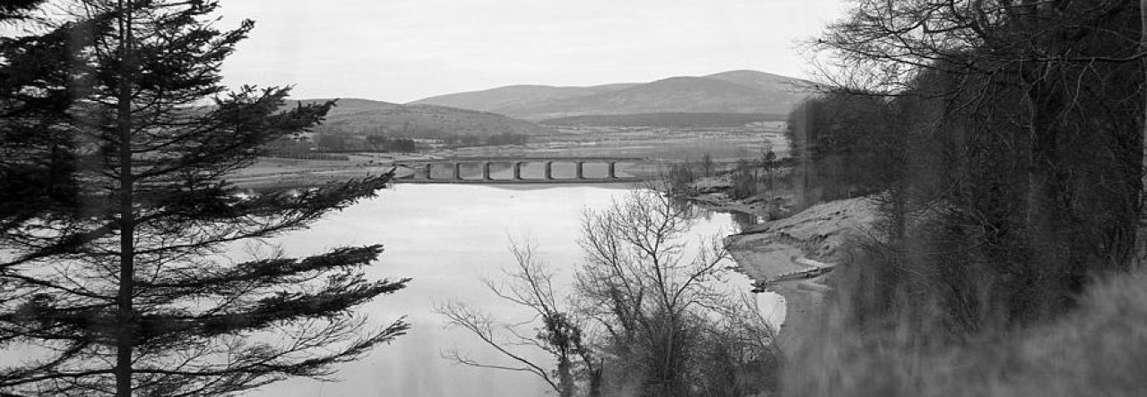
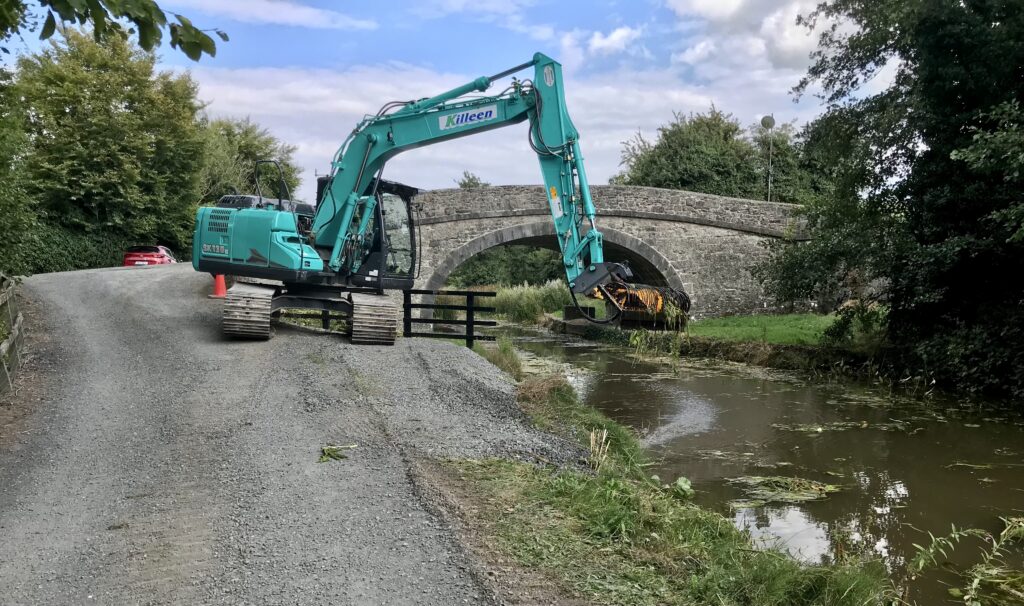
The canal from Naas to Corbally, which is a continuation of the branch from Sallins to Naas, covers a distance of over 5 miles and commenced operations in 1810. The lands needed for the canal itself, the towpaths and any extra ground had been acquired according to law and compensation was paid by the Company to the tenants and landlords in question.
An inquisition as to finding for General Cockburn and his tenants was held on Saturday the 16th day of December 1809 at the Courthouse, Naas, before three commissioners namely: Sir Fenton Aylmer of Donadea Castle, Thomas Burgh of Oldtown, Theobald Barnwall Donnelly of Oakly Park. The twelve jurymen were: Sir Simon Bradstreet (foreman), William Sherlock, Edward Read, Mathew Read, William Mills, George Cooke, John Barker, Joseph Rawlings, William Brownrigg, Henry Hamilton, William Kilbee and Mathew Donnellan.
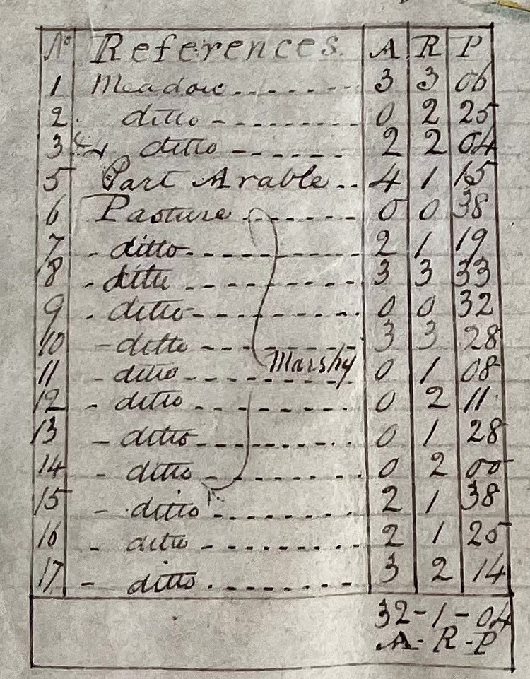
To be decided were the following : the value per acre of the acquired land, the number of years purchase given (18 years purchase was agreed on), measurements of the acreage in question and the number of years left on the tenants’ leases. A map, not now extant, was annexed to the inquisition. However, William Daly’s maps fit the bill, so to speak, for the Newlands estate. The following are some examples of the compensation paid:
Michael, Catherine and Brian Hart.
Years …………….…………….2
Land……………..…………….2 rds 34 pers.
Rate per acre………………..£1 to £1-10-0
Total paid…………………….£1-15-3.5
Sir George Cockburn
Years……………………………16
Total paid…………….………£14-2-4.5
It is interesting that the descendants of the above tenants are still in possession near Connacht Bridge after 200 years.
Stephen Healy
Years……………..…………5 yrs 6mths
Land…………………………23 rds
Rate per acre………………£1-10-0
Total paid…………………..£5-6-1.5
Sir George Cockburn
Years……………………..…..12 yrs 6 mths
Total paid……………………£12-1-6
Andrew Maguire
Tenant at will
Total paid……………………1 Shilling (ex gratia payment).
Bricks were made on the Newlands Estate and could be transported by canal. A notice of bankruptcy proceedings against Bartholomew Peter Fitzpatrick of Newlands, Naas, farmer and brickmaker, and dated 12th September 1879 was circulated to creditors. The petitioner would offer 3/- in the £. Proof of debt ( £10 or more) would be required. His assets were mainly :
Household furniture………£200
Stock of Bricks…………….…£290
Stock & implements………..£979
61 year lease from 1862 valued at………..£4,500
Until recently older residents remembered the ruins of the brickworks in “the brick field.” All traces of it are now gone.
Any comments or questions would be welcome: To contact Jim Corley please click here

Sean Landers
Hi Jim,
Where can I find John Killay’s 1808 survey of the proposed extension of the Naas branch of the canal through Kilcullen ?
s
John Killaly’s
Please excuse the typo.